TopWaterfrontDeals.com Daniel G. Starowicz, P.A., Realtor.  239-603-6100

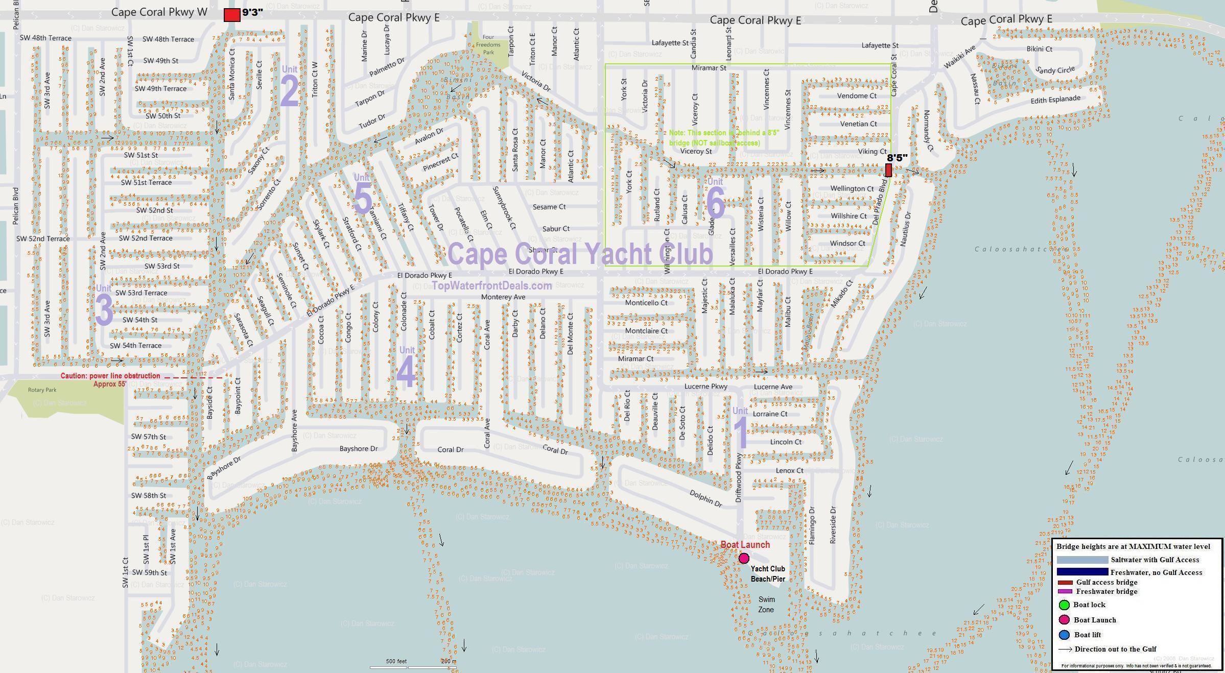
Map of the Cape Cape Coral Yacht Club and Unit 3 canal depths

This map of the Cape Coral Yacht Club as well as the section to the West (called Unit 3) notes the observed depths of each of the canals in this region of the city. It also includes the bridge heights and locations, the location of a power line obstruction, and it also denotes which section is behind a bridge as well as the direction out of the canal system to open water. A legend is included in the bottom right corner. The internet’s only source for this info!

This is a very large image and may take a minute to load.

Cape Coral Yacht Club and Unit 3

TopWaterfrontDeals.com

Lee County

Lee County   SW Florida

This map is provided as a courtesy to customers of Dan Starowicz and may not be used, reproduced, or linked to without express written permission.  Please report any misuse to Dan@DanStarowicz.com

Cape Coral  Yacht Club and Unit 3 canal depths

Copywright 2019. Dan Starowicz. May not be reproduced.

Information is NOT guaranteed, is obtained from third parties and is subject to change.  It is provided for general informational purposes only. It is not to be relied upon for navigational purposes or for the basis of any purchases. Buyer to verify all information.

Did you come directly to this page from a search engine? If so:

Return to the Yacht Club section of site